AMSR-E
Ice covers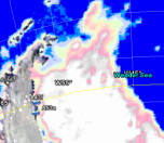
|
The overall daily development in the ice cover around the continent is
presented in the form of passive microwave images generated from data
from the AMSR-E instrument on the Aqua satellite of NASA and JAXA.
Data processing performed at DTU.
|
ENVISAT
ASAR 3-day mosaics |
More details on the
sea-ice conditions as well as iceberg locations are
presented using ENVISAT ASAR data from the European Space Agency.
The images are mosaics of all available satellite passes during the
last three days. Data are available for selected regions only. (The SAR images are turned off by
default, you have to activate them in the "Places" panel).
Data processing performed at DTU.
|
Ice
drift from ENVISAT ASAR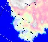 |
3-day ice drift
vectors derived from ENVISAT ASAR data. Data processing
at DTU, ENVISAT ASAR data provided by the European Space Agency.
Ice drift data calculated from ENVISAT ASAR swath data from ESA.
Data processing performed by DTU. During the summer months the amount
of data is rather small since the algorithm does not work so well in
low ice concentrations.
|
Drift
buoys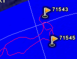 |
Drift buoys. The location of the buoys as well as
the drift track for the past 1-2 months.
Drift buoy locations provided by the Russian Arctic and Antarctic
Research Institute in St. Petersburg. http://www.aari.nw.ru/default_en.asp
|
Larger
icebergs |

Locations of identified larger icebergs.
The iceberg data are provided by the Brigham Young University. http://www.scp.byu.edu/current_icebergs.html
|
R/V-Lance (NPI)
R/V-Polarstern (AWI)
Aurora Australis (AAD)
James Clark Ross (BAS)
Ernest Schakelton (BAS)  |
Location of selected research vessels. Currently we
have included the location of the Norwegian research Vessel Lance, the
German Research
Vessel Polarstern,
the Australian Aurora
Australis, and the
British Research
Vessels RSS James Clark Ross and RSS Ernest Schakelton.
|
Antarctic
stations and bases

|
Location of a selection of more than 120 Antarctic
research stations and bases. - Past and present! |


